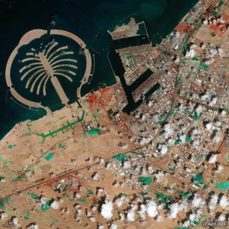
Dubai experienced severe flooding with more than 250 mm of rain causing disruption to the city and flights, as shown in this satellite image from Sentinel-2. Credit: Contains modified Copernicus Sentinel data (2024), processed by ESA
Recent heavy rains in Dubai led to extensive flooding, covering roads and impacting flights. More than 250 mm (~10 inches) of rain came down across the UAE in under 24 hours, as depicted in a false-color satellite image from Copernicus Sentinel-2, which shows flooded areas and vegetation.
Dubai has been struck by heavy rain that flooded the desert city – covering roads and vehicles and causing flight disruptions. More than 250 mm of precipitation is reported to have fallen across the United Arab Emirates in under 24 hours.
This false-color composite image from Copernicus Sentinel-2, taken on April 17, highlights flooded areas in turquoise. Red areas in the image indicate vegetation.
Sentinel-2 supplies important data for monitoring and managing floods, allowing for timely and accurate evaluation of the extent and severity of floods through high-resolution satellite images.